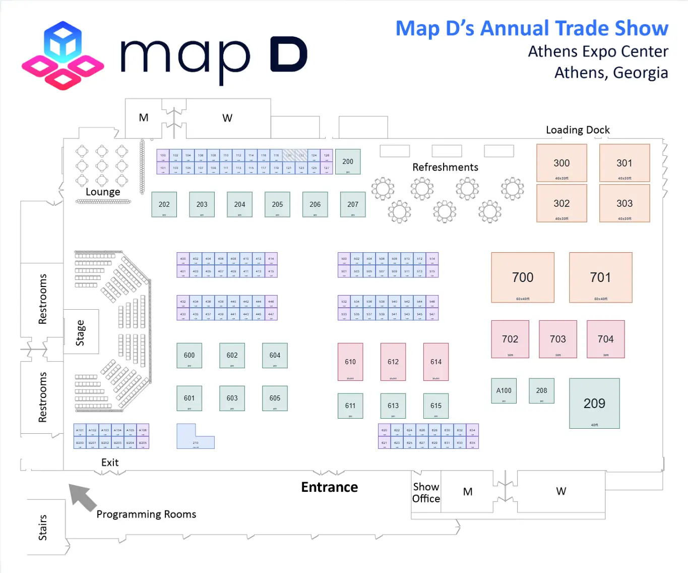
Event Wayfinding Software

Let attendees tap any booth on the floor plan and get turn-by-turn directions from anywhere. Map D draws the exact path they'd take, routing them across floors via stairs, escalators, and elevators.

Build your floor plan free
Buyer summary

What is event wayfinding software?

Event wayfinding software gives attendees point-to-point directions across a venue on their own phone, without a printed map. Map D routes between booths, sessions, and amenities, connects multiple floors and buildings, and starts a route from any booth on the live floor plan.

Best for
Large or multi-floor venues where attendees routinely get lost
What to evaluate
  • Point-to-point routing
  • Multi-floor connectors
  • Works on any device

Trusted by leading associations

  • naa
  • new york school nutrition-association
  • gsae
  • bmsa
  • fhba
  • american distilling institute
  • cannacon
  • aia florida
  • the fit expo

Everything attendees need to find their way

Tap a Booth, Get Directions

Attendees tap an exhibitor on the interactive floor plan and Map D instantly draws the shortest walking route from their location. The highlighted path keeps them oriented from start to destination, and they can re-route to a new booth in a tap so nobody gets lost between sessions or aisles.

Seamless Multi-Floor Routing

Large venues span multiple halls and floors. Map D connects maps with stairs, escalators, and elevators so a single route can carry attendees across levels and buildings. Step-free options keep the experience accessible for every guest.

A Guided Experience, End to End

Point-to-point wayfinding turns a busy show floor into a guided experience. Attendees spend less time searching and more time visiting booths, sponsors get more foot traffic, and organizers field far fewer directions questions, all from one live map that lives on your site and in your app.

See event wayfinding from the attendee's view

See how attendees find exhibitors, booths, and destinations on a live Map D floor plan.

More ways to guide attendees across the floor

Point-to-Point Directions

Attendees select any two booths, or use their current booth as the start, and Map D draws turn-by-turn walking directions between them. Distance and estimated walk time are shown up front, so guests can plan their visit and reach the next meeting on time. Routes update instantly whenever they pick a new destination.

Find your wayHall A to Hall B
ROUTE

Turn-by-turn from where the attendee is standing to the booth they saved.

Multi-Floor Connectors

Connect multiple maps with stairs, escalator, and elevator connectors so routes flow across floors and buildings. Map D hands attendees off to the right connector and resumes directions on the next level. Step-free routing offers an accessible path for wheelchair users, strollers, and anyone avoiding stairs.

Hall A · Wayfinding
Keynote · 10:00
Room 204 changed
Your Brand, Your App
  • Wayfinding on the live plan
    Same map the organizer publishes
  • My Schedule & Bookmarks
    Sessions, speakers and saved exhibitors
  • Push alerts
    Room changes reach the floor in seconds
iOSAndroidWhite-label

Click a Booth to Route From Anywhere

Every exhibitor on the floor plan is a tappable destination. Attendees search by company, category, or booth number, then route to it from wherever they are. Bookmarks and shared routes make it easy to build a personal plan for the day and send it to colleagues.

Spring Expo 2026 — Halls A & BPublished
Hall A floor plan with booths colored by sales status
AvailableReservedSoldUnavailable
See it on your own floor plan

Stop reading about it. Build one.

Upload the floor plan you already have and place your booths on it yourself, in Map D’s editor. Free to build, no contract, and nothing to install.

800+
Organizers running shows on Map D
6,000+
Events powered every year
800,000+
Booths drawn to date

“I am really excited about this. The staff met with me this morning and we all LOVE the platform. People are already filling out their booths.”

Director, International Trade and Development @ Maine Insurance Agents Association

Our event wayfinding software capabilities

Built for Large, Multi-Hall Venues

Built for large trade shows, conferences, and multi-hall venues where attendees need help moving between booths and floors quickly and confidently.

Always in Sync With the Floor Plan

Wayfinding rides on the same live floor plan, so booth moves and layout changes appear instantly. Routes and search always reflect the latest map with no separate update step.

No App Download Required

No app to download. Attendees navigate from any phone browser or on-site kiosk, and the map embeds on your website and event app with a simple snippet.

Accessible for Every Attendee

Step-free routing and clear, simple directions make the venue easier to navigate for every attendee, reducing crowding and lowering the load on your on-site staff.

Your question answered

These are some of the most common questions about point-to-point wayfinding, on-map routes, and routing attendees between booths and floors at live events.

Contact us

What is event wayfinding software?

Event wayfinding software gives attendees interactive, point-to-point directions across a venue. With Map D, visitors select any exhibitor or booth on the digital floor plan and instantly see the best route from their current location, drawn as a clear path across the map to follow.

How are directions shown on the map?

Attendees choose a starting booth and a destination, and Map D highlights the recommended walking path directly on the floor plan. The route is drawn as a clear line across the aisles, and for multi-level venues it continues onto the next map through the right connector, so guests can see the whole way at a glance before they set off.

Can attendees get directions between any two booths?

Yes. Attendees can pick a starting booth or use their current location, then tap any destination booth to get directions between the two. Routes can be started from any booth on the floor plan, not just entrances.

Does it support multi-floor routing?

Map D links multiple maps together with connectors for stairs, escalators, and elevators. When a route spans floors the directions guide attendees to the right connector and continue on the next map, so multi-level and multi-hall venues stay easy to navigate.

Does the wayfinding map embed on my website and mobile app?

The wayfinding map embeds on your website or event app with a short snippet and works on any phone, tablet, or on-site kiosk. No app download is required for attendees to start navigating.

Does wayfinding stay accurate when the layout changes?

Because wayfinding is built on the same live floor plan, any change to booth positions, names, or the layout is reflected instantly. Routes and search results always use the latest map, so attendees are never directed to an outdated location.